


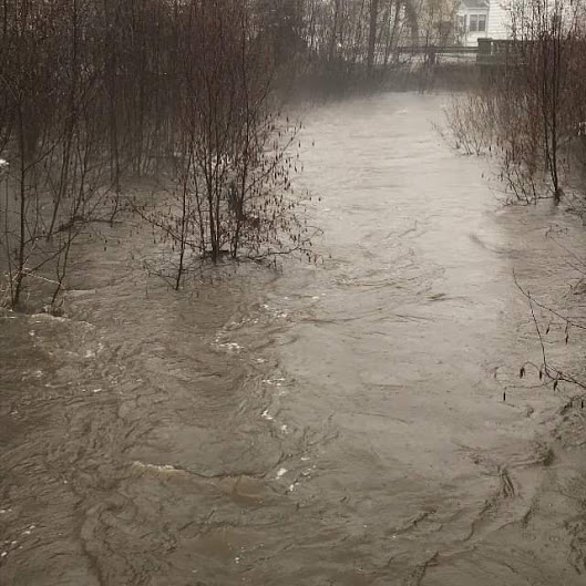
After a holiday weekend that saw localized flooding in and around the North Bay area — and the closure most of the day yesterday of Highway 17 in Calvin Township, an update on the flooding situation.
The Ministry of Natural Resources and Forestry – North Bay District is advising area residents a Flood Warning remains in effect in the southern portion of the District until Thursday. A Flood Warning is issued when flooding is imminent or occurring within specific watercourses and municipalities.
This warning encompasses the Sturgeon River, Lake Nipissing and Upper French River Watershed, as well as the South River. Water levels and flows in local lakes and rivers will remain high following significant snow melt and rainfall that moved across the area. A Flood Watch remains in place for the rest of the North Bay District.
Residents and those visiting the area are advised to be aware of current watershed conditions. Higher than normal water levels and flow conditions, typical of this time of year, exist throughout the area and residents are reminded to keep a close watch on weather conditions, regularly check for updated messages and exercise caution near
fast-moving rivers and streams.
It is expected that lower-lying portions of known flood-prone roads along river courses will be impacted to various degrees as lake and river levels continue to increase this week. Banks and shorelines adjacent to water bodies are extremely slippery and unstable. Residents and visitors should exercise caution while around water bodies and maintain close supervision of children and pets.
Residents that may be affected by high water conditions should take necessary action to protect/secure any vulnerable property in proximity to rivers and lakes. The Ministry is closely monitoring the weather and developing watershed conditions. Further updates will be issued as appropriate.
Mid-April snow surveys show a continuing snowpack of between 16 cm to 93 cm and ranging from 33 to 221 mm of snow water equivalence. These values are above average to well above average for this time of year.
Water levels and stream flows across the North Bay District are elevated from ongoing spring snow melt and past precipitation events. The impact of recent warm temperatures and rainfall have compacted the significant snow pack reducing its ability to absorb rainfall. The forecasted warm temperatures and precipitation are likely to further degrade the snowpack and river ice and continue to produce runoff and increase levels and flows. Warm temperatures in advance will deteriorate snowpack and further prime it for release and melt.
Risks may include degradation of river ice and ice jam-related flooding from increasing temperatures and flows, fast-moving cold water with rapidly changing conditions, and flooding of low-lying areas with a history of flooding.
A close watch on local conditions and weather forecasts from Environment Canada is recommended. See the Surface Water Monitoring Centre public webpage here.
