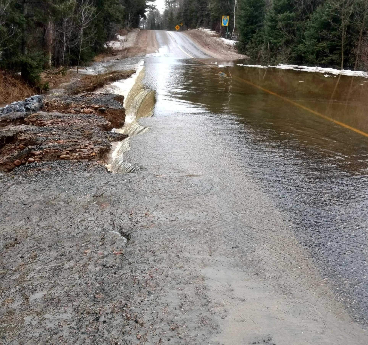
A forecast containing heavy rainfall has prompted the extension and expansion of the Flood Warning from the North Bay-Mattawa Conservation Authority (NBMCA).
Area lakes and rural watercourses, already swollen and in some cases flooding from melting snow, rain and runoff, could see up to 50 millimetres of rain in the coming week, prompting the NBMCA to expand the Flood Warning to include Lake Nipissing — and extend it until next Thursday.
“It is expected that Lake Nipissing will reach 15 cm above the summer operating level by this weekend. Lake Nipissing is also forecasted to reach the flood threshold at which damages may begin to occur, by May 2. This may pose a threat to properties along the Lake Nipissing and Callander Bay shoreline, particularly if there are strong winds or waves, said Kurtis Romanchuk, NBMCA’s Duty Officer.
“NBMCA is preparing to operate the Backflood Control Structure on Parks Creek, if needed, to prevent the rising waters from Lake Nipissing from flowing upstream into Parks Creek,” he added.
Flooding is occurring in low-lying areas around lakes and watercourses, particularly along large rural systems where runoff is accumulating. Wasi Lake, Trout Lake, Lake Talon, Lake Nosbonsing, and other lakes along and near the Mattawa River are currently experiencing very high water levels, and water levels will likely continue to rise with the forecasted rainfall. Urban watercourses including Chippewa Creek may experience a quick rise in response to any intense rainfall event.
Flood Warning notifies that flooding is imminent or already occurring in specific watercourses or municipalities. Municipalities and individuals should take action to deal with flood conditions. This may include road closures and evacuations.
Since April 18, more than 55 mm of precipitation has fallen, and more than 100 mm of snow-water-equivalence has melted. Between 10 and 30 mm of rain is forecasted for tomorrow, and up to 50 mm through this week, with some variability between weather forecasters.
The MNRF reports due to the combination of rainfall and snowmelt, water levels and stream flows across the District have risen sharply and have reached or exceeded flood stage in many
areas.
Road closures and sandbagging has been reported and area residents have been impacted by flooding. Localized flooding has been reported on much of the southern portion of the District, which includes the Tomiko River, Sturgeon River, Upper French River, Mattawa River, Pickerel River, Wolf River, Restoule River, South River as well as creeks and streams that flow into sections of these respective watersheds.
Like the NBMCA, the MNRF is closely monitoring the weather and developing watershed conditions. Further updates will be issued as appropriate.


